
Ever thought a simple map could boost your golf game? It might sound small, but a good course map can really change your play.
Imagine laying out every hole right before you swing, seeing tee boxes, fairways, and even hazards like bunkers and water traps. It’s like having your own mini playbook tucked in your bag.
In this post, I'll walk you through the basics of reading a course map so you can decide on the perfect shot every time.
Mastering How to Read a Golf Course Map: Step-by-Step Diagram Guide
Using a golf course map gives every golfer, whether you're just starting out or have been playing for years, a real advantage. It lets you see the whole course from above before you hit the tee and helps you plan your game. A good map shows you the tricky parts of each hole so you can decide which club to use, just like how many players study the layout to avoid unexpected mistakes.
Most golf courses have 18 holes, and each one includes different parts like the tee box, which is where you begin; the fairway, the main area where your ball usually lands; the rough, which is longer grass that can slow you down; the green, where you aim to land your ball close to a small flag; and hazards such as bunkers or water traps that you want to steer clear of. Every course has its own flavor. Some courses, like links, have sandy soil and deep bunkers, while parkland courses are lined with trees. Then there are heathland courses, common in the UK, and desert courses with rocky ground and steep changes in height. Knowing these differences can really help you plan your shots.
Start by taking a good look at the overall shape of the course to see how each hole connects. Check the path from tee to green and keep an eye on markers like hazard spots and distance signs. Notice details like the wind direction and any hills or dips that might change how your ball moves. These hints help you pick a safe place to land your shot and choose the right club. In essence, your map turns into a handy playbook that makes tackling the course a lot more fun.
Decoding Map Legends and Layout Symbols on Golf Course Maps
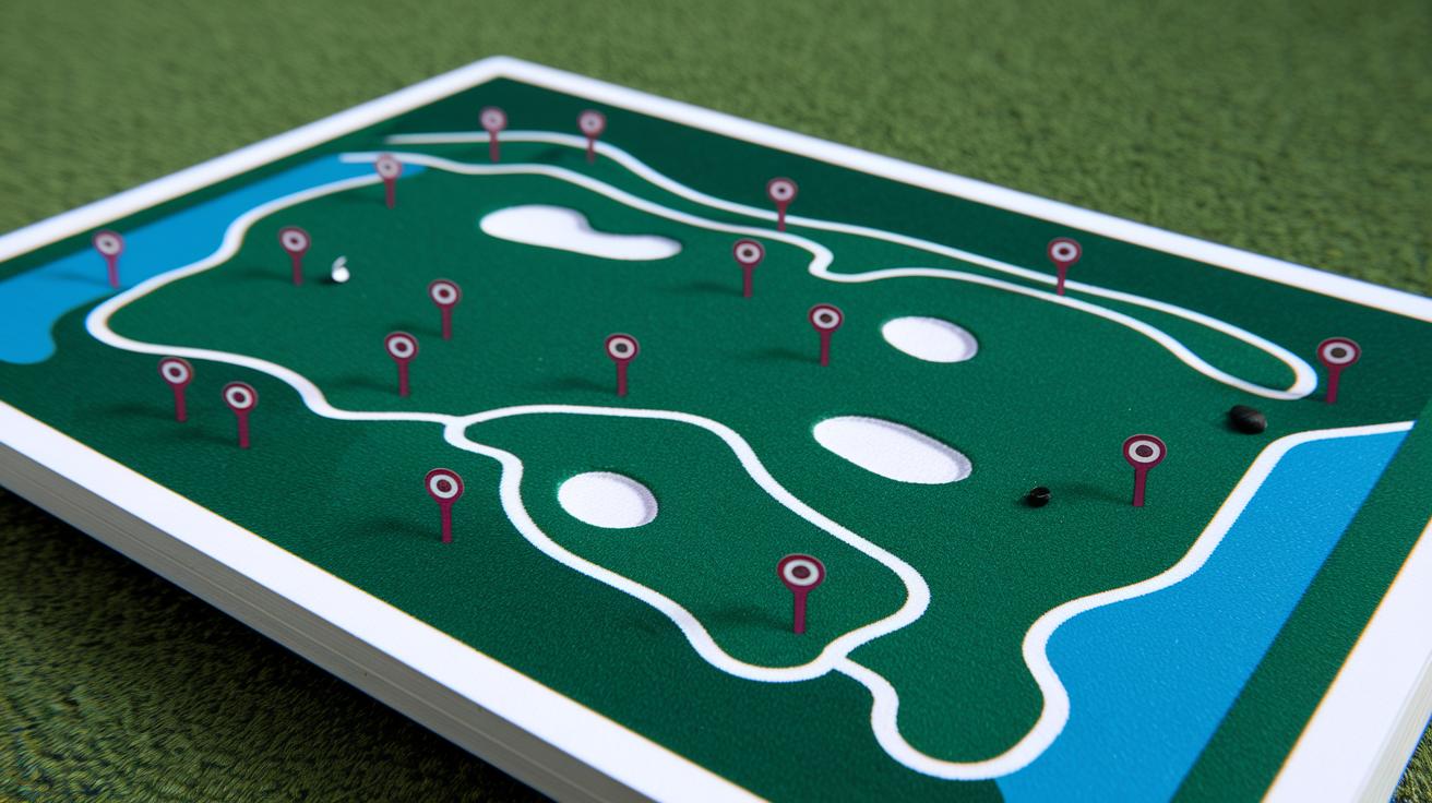
Imagine your golf course map is a secret message waiting to be cracked. The map legend is your go-to guide, showing you what each little symbol means. It explains the colors and shapes, so you instantly know if you're looking at a tee marker or a water hazard. This little cheat sheet helps you dodge surprises on the course, letting you focus more on planning your next shot rather than hunting for hidden bunkers.
Next, check out the six most common symbols you’ll see on almost every map. They point out your starting spot, the main playing area, and obstacles you need to watch out for. When you recognize these icons, picking the right club becomes a whole lot easier. If you spot a bunker near the green, for instance, you might opt for a club that can help you steer clear of the sand. The legend basically turns the map into a handy tool for smarter shot planning.
| Symbol | Meaning |
|---|---|
| Tee Marker | Starting box location |
| Fairway Boundary | Primary playing corridor |
| Bunker | Sand obstacle |
| Water Hazard | Pond, stream, lake |
| Green | Putting surface |
| Rough | High-cut grass area |
Interpreting Topography and Elevation on Golf Course Maps
When you check out a course map, those contour lines make reading the hills a breeze. They mark changes in height, usually every 5 or 10 feet, and help you spot when you're facing an uphill or downhill shot. Tightly packed lines mean the ground is pretty steep, making shots harder, while wider gaps signal a gentler slope that might let you keep your swing smooth.
Next, consider dogleg holes. These curved parts of the course mean you need to plan your shot carefully. The map’s marked slopes show you where it's safe to land and where the ball might roll away, which could affect the club you decide to use. Whether a green sits up high or drops suddenly, knowing the course’s natural lean helps you pick a shot that rides the flow of the land and keeps your game on point.
Calculating Yardages and Distance Measurement on Golf Course Maps

Ever notice how helpful those yardage markers are? When you see markers placed at 100, 150, or 200 yards from the green, or a scorecard with a scale bar (like 1 inch equals 50 yards), it gives you a quick feel for how far you are from your target. They let you pick the right club without a second thought, so you can focus on planning your shot.
Many golfers also lean on yardage books and GPS apps to get even more precise. These tools double-check the markers on your map and overlay exact distances right on your screen. Whether you’re checking a printed map or scrolling on your phone, these aids help make sure your shot planning is as accurate as possible. And when the wind picks up or you’re facing a hill, digital tools help you adjust your strategy on the fly.
- Identify where you are on the course (tee, fairway, or near a marker)
- Look for the nearest yardage marker or scale bar
- Use a straight edge or string on the map to connect the points
- Factor in any changes in elevation, whether uphill or downhill
- Confirm your distance with a GPS or digital rangefinder
Identifying Hazards and Strategic Features on Golf Course Maps
When you check out a course map, you'll notice small icons marking bunkers and water hazards. Bunkers show up as tiny, sandy symbols near fairways or around greens, while water hazards appear as blue areas. These visuals help you decide which club to use and how hard to hit your shot. Ever felt that moment of clarity when you spot a blue water hazard and know to ease up on the swing?
The map also points out rough spots with a shaded, speckled look. This isn’t just a warning, it shows you where the thick grass might slow down your ball. With these details in mind, you can aim for those open, well-kept parts of the fairway to keep your game on track.
Planning Shots and Club Selection Using Golf Course Maps

Before you head to the tee, take a moment to study your course map. Look at the shape of the hole and find the flag so you can sketch out a smart game plan. Keep an eye out for spots where the wind might mess with your shot. And don’t forget to check the course rating and slope, these clues will tell you if a curve or hill is likely to alter your ball’s path. Fun fact: one pro once mapped every detail of each hole, including wind direction, before his first tournament, turning uncertainty into a winning strategy.
Once you’ve scribbled down your notes, start picking out safe landing zones. The map can point you to corridors that steer clear of hazards like bunkers, water, or thick rough. When you spot a bunker near the green or water lining the fairway, aim for open spaces that offer a secure landing spot. This lets you decide whether to play it safe or take a more daring shot based on the obstacles ahead.
Finally, blend all this info together when choosing your club. Use the yardage details from your map along with hints of elevation and other features to decide if a driver, iron, or wedge is best for the shot. Think about how a hill or dip might change the ball’s approach. With a clear map read, every club choice becomes a calculated step that boosts your confidence and sharpens your game plan.
Final Words
in the action, the blog took you through reading course layouts, spotting key hazards, and calculating yardages. It offered tips on interpreting map legends, topography, and pinpointing safe zones for each shot.
Step-by-step, it showed how to use course features to guide club selection and shot planning. This simple, clear guide on how to read a golf course map helps boost your confidence and game. Enjoy putting these strategies to work on your next round.
FAQ
Frequently Asked Questions
What are the key terms in a golf course layout and diagram?
The key terms include the tee box (starting point), fairway (main playing area), rough (long grass area), hazards (obstacles like bunkers or water), and green (target area).
What does a golf course layout app do and how do you layout a golf course?
A golf course layout app offers digital tools to design courses by marking tee boxes, fairways, hazards, and greens, helping plan each area for safe and strategic play.
Where can I find free golf course maps and design standards PDFs?
Free golf course maps and design standards PDFs are available on various websites, providing detailed layout guidance and regulatory design details for creating quality courses.
How do you read a course guide, yardage book, and yardage markers?
Reading a course guide, yardage book, and markers involves reviewing hole diagrams and distance indicators to understand shot lengths and key features for better club selection.
How far is an 18-hole golf course in miles?
An 18-hole golf course generally covers about 4 to 7 miles, with distances varying based on course design, terrain, and overall layout.
What does 1/2/3 on a golf green mean?
The numbers 1/2/3 on a golf green indicate different pin or flag positions, guiding your shot approach by showing where the hole is placed on the putting surface.